After Hobbiton we head through Auckland. After living in a village of 50,000, driving through rush hour Auckland was nothing short of traumatic. Curse it. We headed up the peninsula north of Auckland to a province named, strangely enough, Northland. (I live in Southland for what it’s worth. And my favorite town motto is for Lumsden: “The heart of northern Southland”)
 The area around Russell and Paihia and Kerikeri is referred to as the Bay of Islands. In the early history of (colonial) NZ, this was where the action was. The British representative had his very modest home near Paihia, across the bay from Russell (or Kororareka as it was called at the time). Kororareka was where the ocean whalers, mostly Americans from New England, would spend their R&R. Referred to as “the hellhole of the Pacific” by more cultured citizens (i.e. missionaries), this was not far from the truth as these sailors were beyond the reach of Western law. However, if you had this guy living just outside of town, it might restrict your behavior just a bit, especially if he intended to have you over for dinner if you stepped too far out of line. And I mean FOR dinner, as in, the main course.
 There is a story (written 1827) by an early observer (an artist who later accompanied Charles Darwin on the Beagle) about a kookie (boy slave) who wasn’t paying attention and allowed the hogs to wander into the chief’s garden and reek havoc. The chief whacked him with his club and ate him for dinner. Mmmm, finger lickin good!
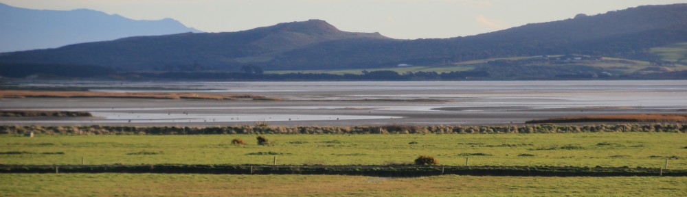
After awhile, we (Pakeha or white people) started handing out guns to our friends, making for an uneven playing field. Of course, that means if a few people have guns, then everyone needs guns (a concept most recently adopted by the NRA). The result was a destabilized Moari society that was being ripped apart by the Musket Wars (note to American people). Some chiefs approached the British and requested that they sort of be in charge. The result was the Treaty of Waitangi, signed on the grounds of the aforementioned now governor’s residence. This photo is looking out from the grounds (towards the hellhole of the Pacific)
 A treaty was signed by all (many) of the rangatira (tribal chiefs) across the islands, giving the British sovereignty (governance) over the islands. The parenthetical words are not explanations. They were what was in the Maori translation. What the Maori signed. This would be similar to having all of the American Indians sign a single treaty where the English version established absolute rule while the Indian translation suggested a leadership role for the President.
The treaty, signed in 1840, is considered the founding document of the nation and Waitangi Day is a sort of Fourth of July and Thanksgiving rolled into one.
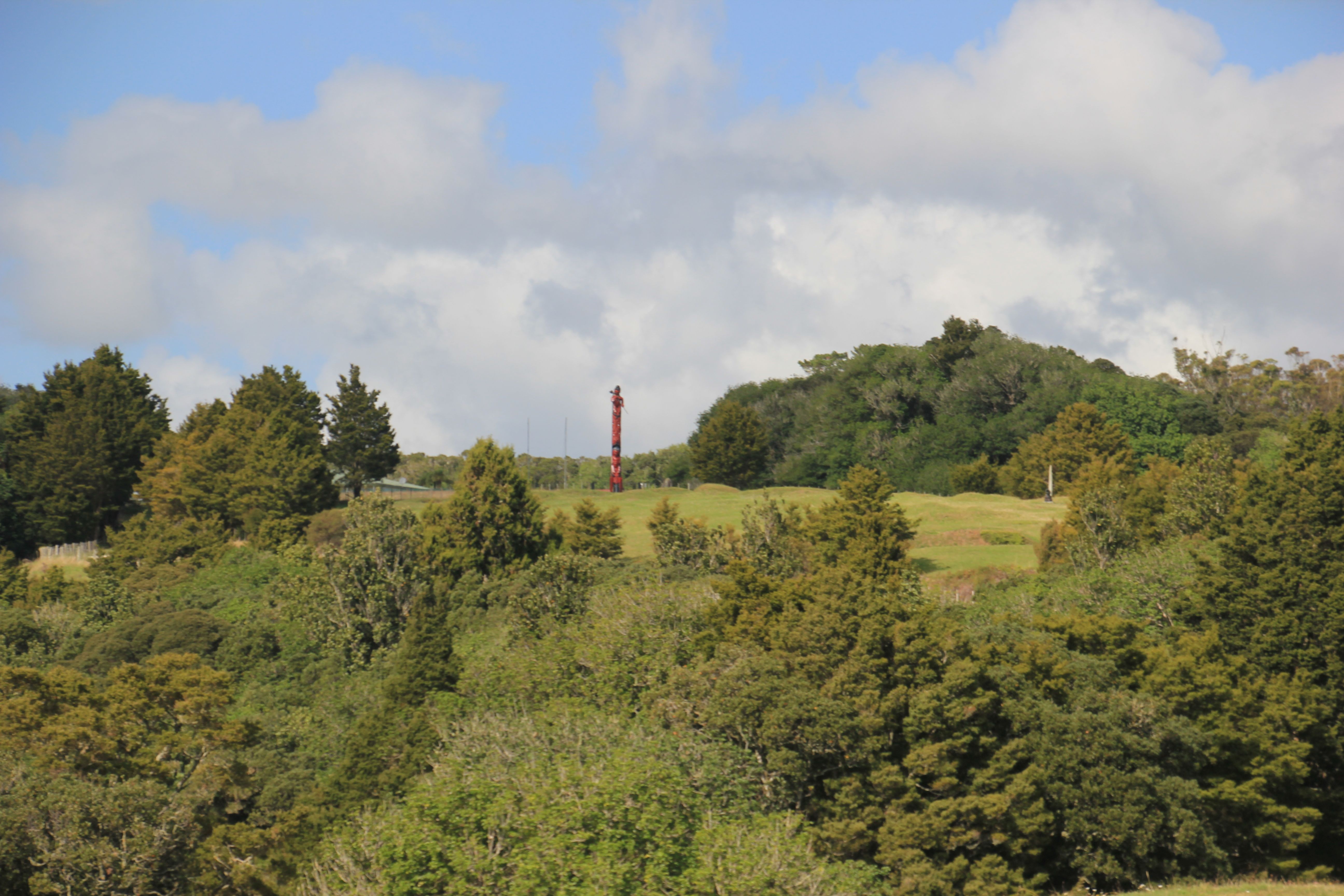
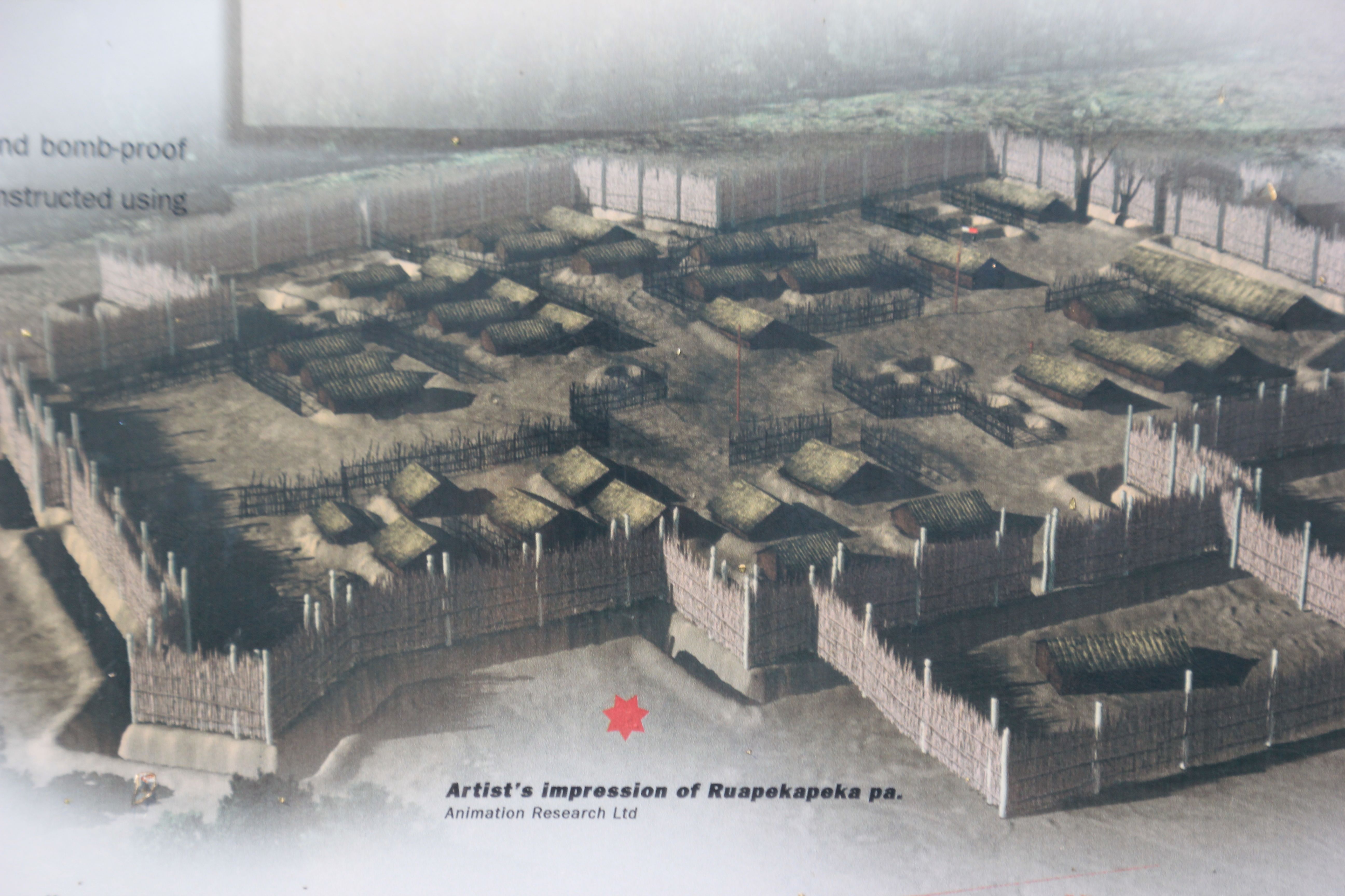
Well, this was all well and good until Hone Heke (the Moari John Hancock of the treaty) realized that the British had a rather different perspective on what had been signed. So he kept chopping down the British flagstaff. After the fourth time, the British decided enough was enough, Heke cried Geronimo!! (not really) and moved with his guerrilla force through the forest. Not an easy target for the British. The last battle was fought at Ruapekapeka, on a hillside surrounded by forest. The British dragged in their cannons, breached the walls, and found…an empty fort. Eventually, the Moari needed to go home and grow some food, so peace ensued and the rest is history.
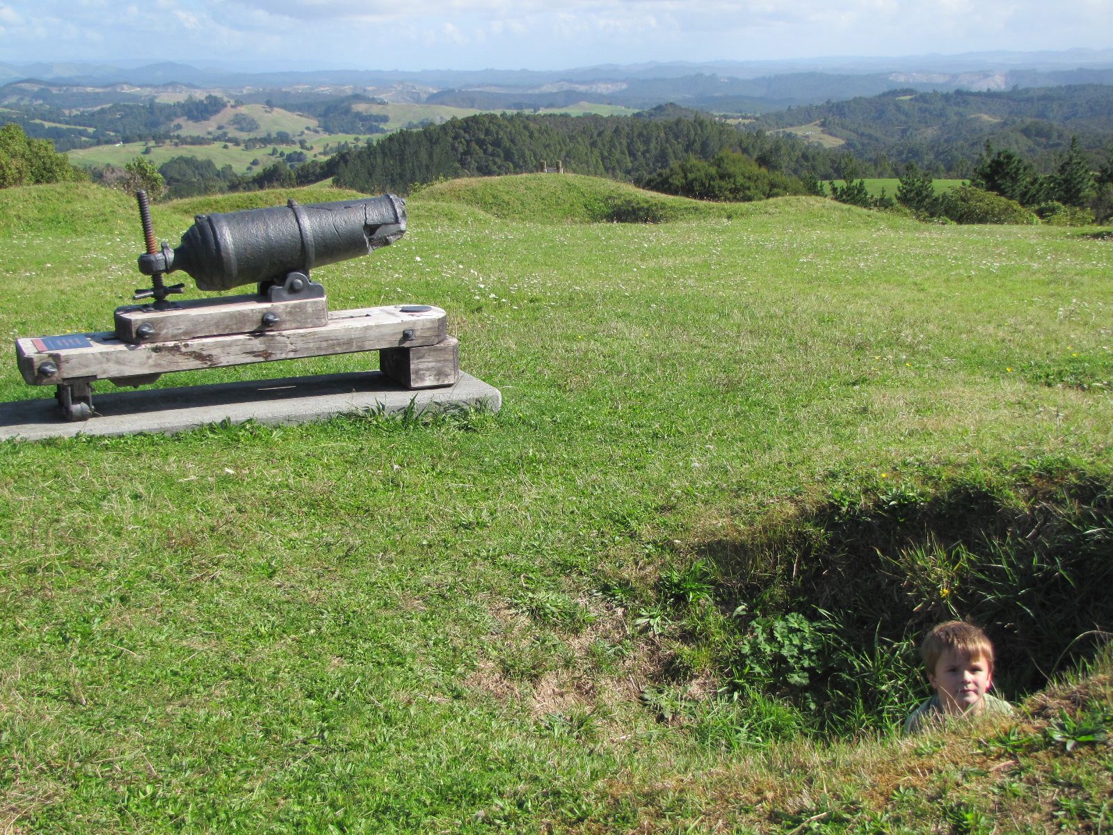
Here is Ruapekapeka today, but you can imagine fighting a fort on a jungle hill with muskets and a couple cannons you had to drag all the way in.
 Looks like any Revolutionary war site in the States – hill, no trees, a few holes in the ground where a pit existed. Use your imagination: bunker? wine cellar? latrine? BBQ pit?
 This ends the history lesson, but suffice it to say, the treaty was a little unfair. By the late 20th Century, the Maori constituency began to rise up and remind everyone that even as one sided as the treaty had been, the Crown (the Kiwi name for their government to this day) has not lived up to its promises. In 1975 the Waitangi Tribunal was established to hear claims for redress and to date over $700 million has been allocated to Maori tribes. Our version of this same process of redress has been to condone the establishment of reservation gambling resorts (which does little to help many of the our native Americans who were driven into the remotest corners of the nation).
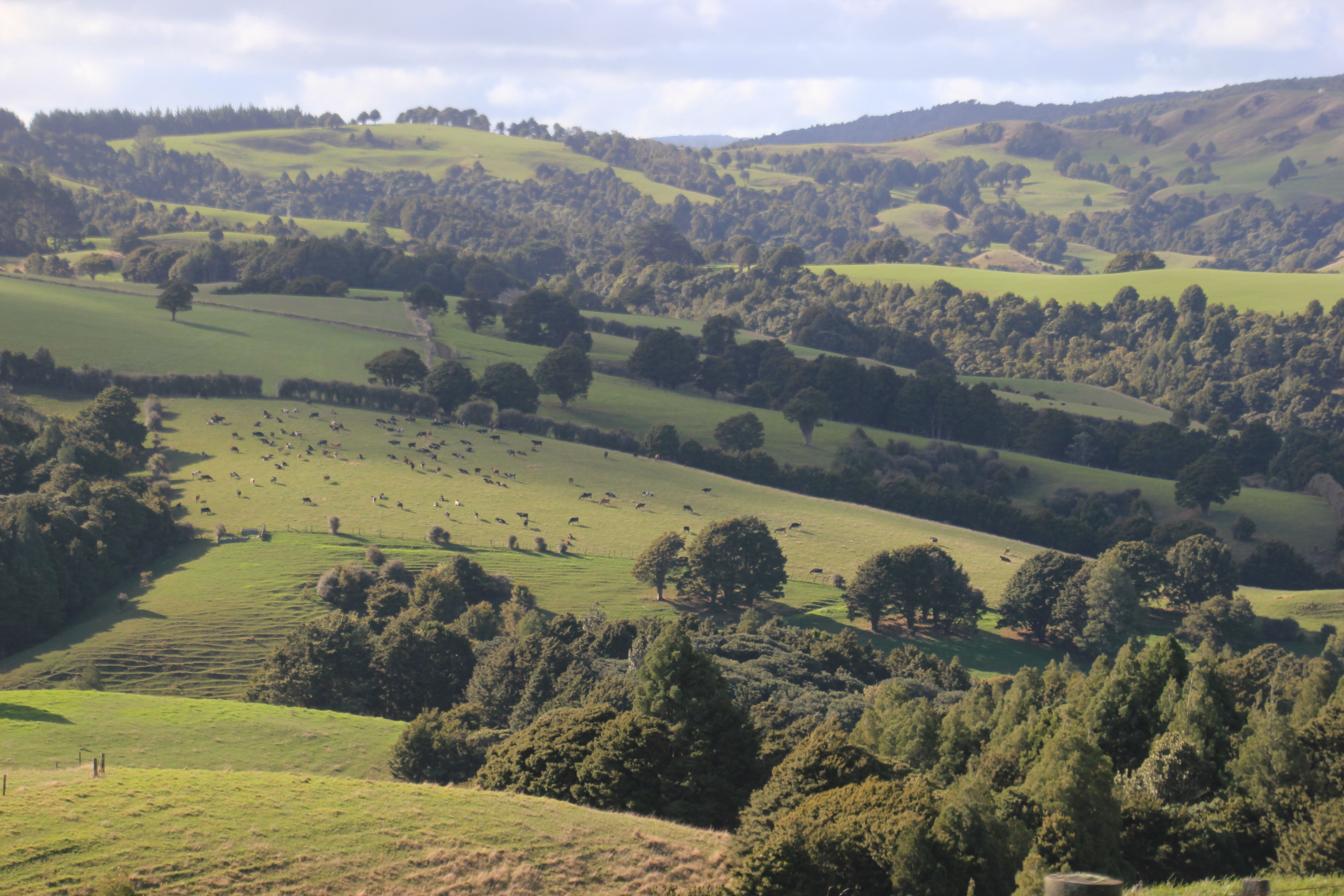
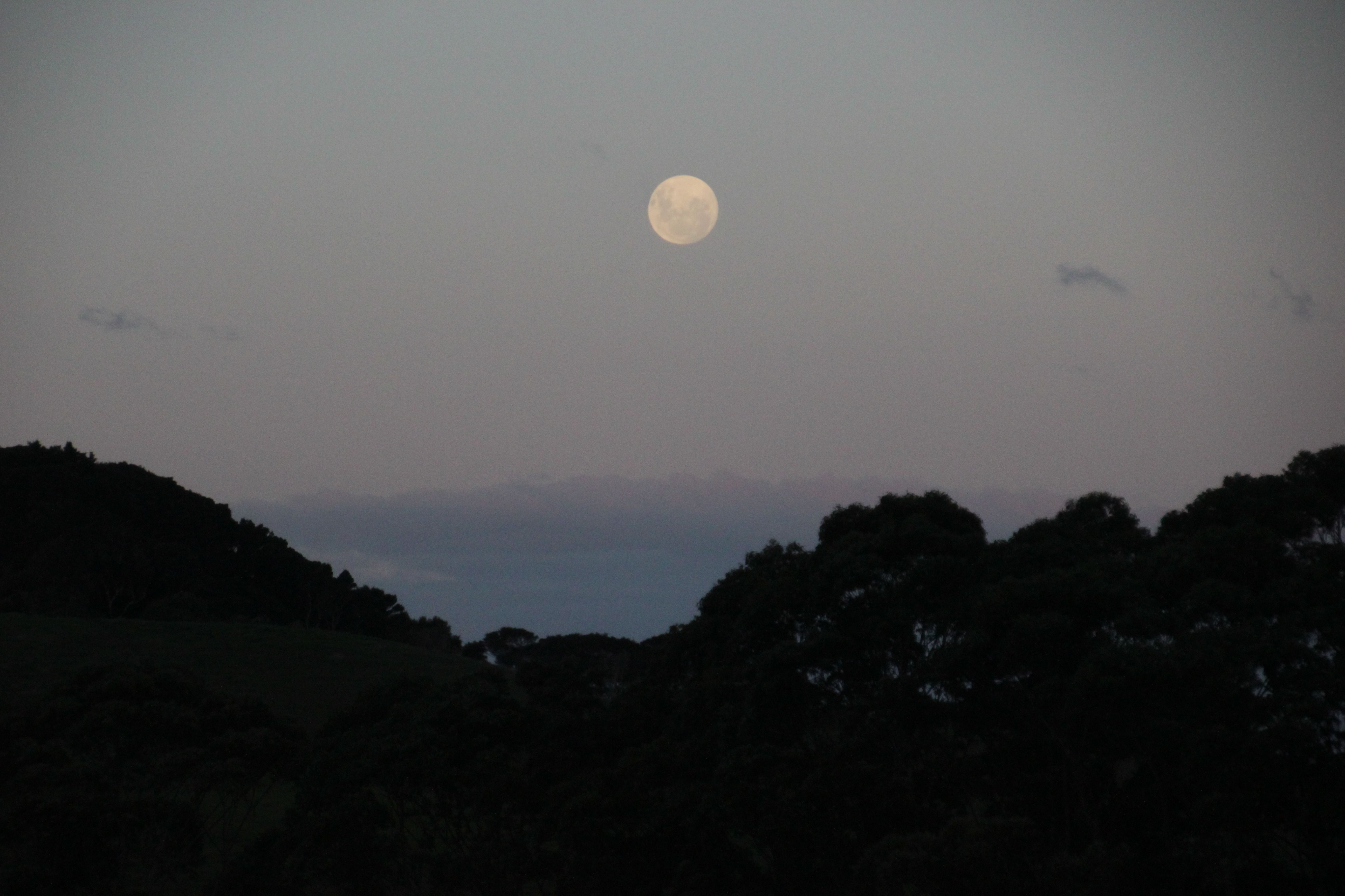
On a less historical but more scenic note, just down the road is yet another typical NZ landscape
 But in the evening
 On the other side of the peninsula is Hokiangi which, along with the Bay of Islands, is one of the oldest Maori settlements in Aotearoa (New Zealand), dating back to the 1300s and host the second and third oldest European settlements.
 Never ones to let a good thing go to waste, these industrious Europeans proceeded to reduce the dense Kauri forest to scrubland. As one commentator noted: By 1900, the bulk of the forest had sailed over the bar and the little topsoil that remained was turned to dairy farming for butter production.
 South of Hokiangi is the sparsely populated remnants of the Kauri Coast, where the few remaining majestic Agathis australis (Kauri) trees, among the largest and oldest trees in the world, still reside. The antecedants of these trees date back to the Jurassic period 150 million years ago. Their size rivals that of the American sequoia. As recently as 1908, a tree this size would have sold for 2 pounds ($100 NZ dollars in current accounting).
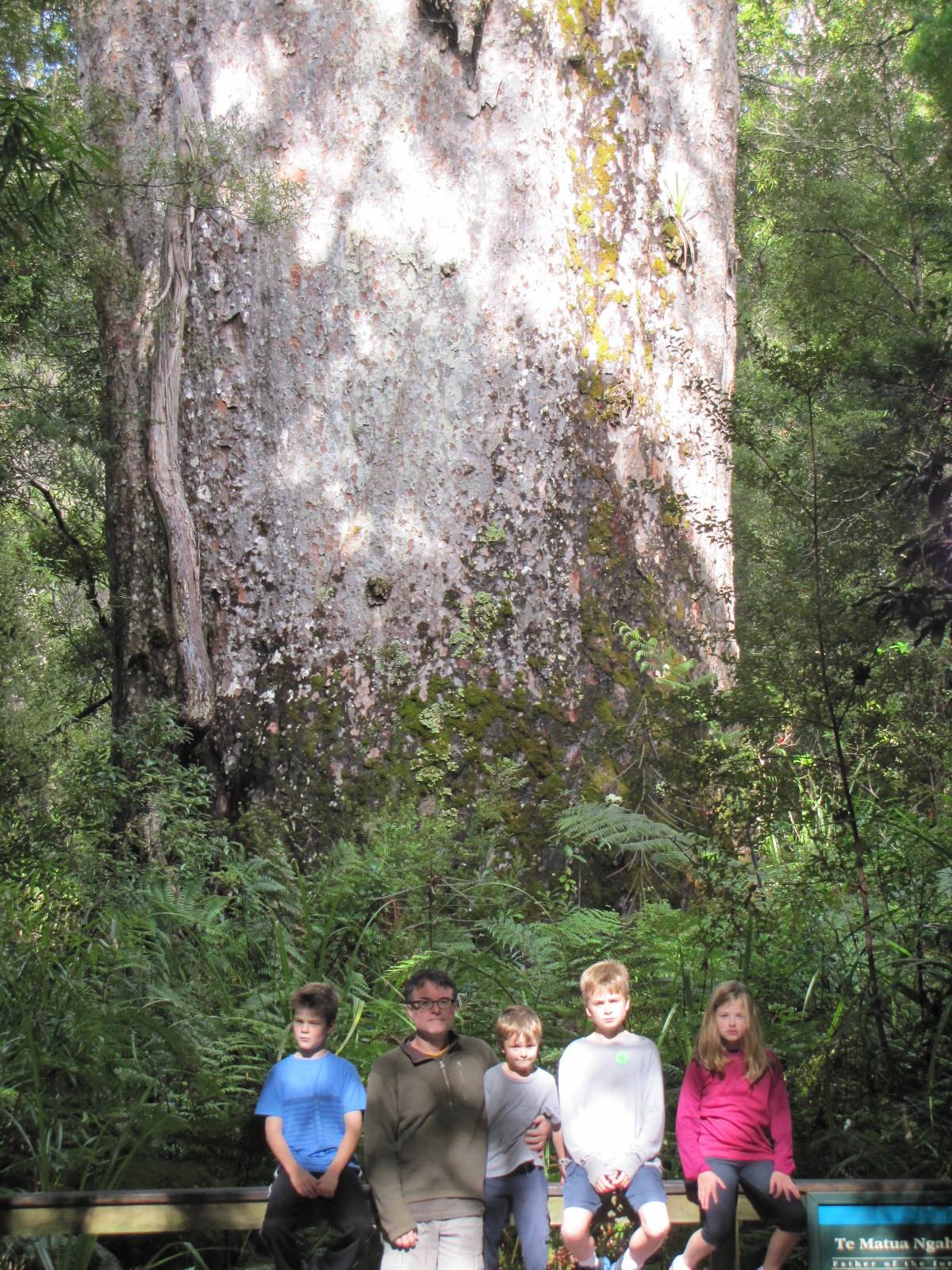 Okay, so we were all tired.
But finally, once you exit the forest you are back to….